|
|
|
|
|
|
| Distance : 5 - 6 miles | Grading : +++ | OS Sheet : 192 |
![]()
This walk starts easily, with a flat walk along the promenade through Exmouth. Depending on the tide you may be able to walk along the beach to Sandy Bay, though you are more likely to have to climb Orcombe Point. From Sandy Bay there is a steep climb followed by a slow descent into Budleigh Salterton. The scenery is excellent on this walk with high red cliffs, good beaches, and in spring the gorse bushes. There is some walking adjacent to the road in Exmouth.
![]()
Exmouth is easily reached on the A376 from junction 30 of the M5. There is plenty of parking in Exmouth. There is parking behind the beach although if this is busy there is a large car park near the station and also car parks for the town centre and shops.
There are trains every half hour to Exmouth from Exeter (Monday - Saturday, less frequent on Sundays) and take about 25 minutes. These connect with main line trains at Exeter St. Davids and the city centre from Exeter Central. The line runs along the edge of the Exe estuary, giving excellent views accross the river to Starcross and Dawlish Warren. The station is a short walk from the coast path.
Bus service 57 operates very regularly from Exeter to Exmouth and takes about 35 minutes. For more information see the links below.
There is a large range of accommodation in Exmouth. The tourist information centre, in magnolia gardens, near the clock tower on the sea front, is a good place to start. The choice of accommodation in Budleigh Salterton is a little more limited, but again there is a tourist information centre which will be able to help you out.
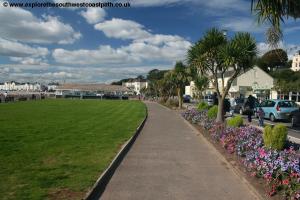
Exmouth is a fair sized town, with lots of facilities. Around the area there are good sports facilities at Phear Park, including a large pitch and putt course and tennis courts. Along the sea front there are amusements, a crazy golf course and a model railway. Boat trips regularly operate around the bay and up the Exe estuary and are well advertised along the sea front and in the docks.
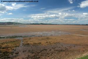
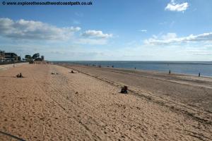
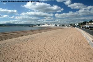
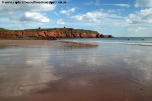
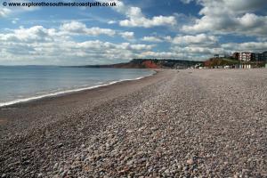
The path starts in the docks / harbour to the west of the town, where many modern apartments have recently been built. From here it's a flat path all along to Orcombe Point. There is a good beach in Exmouth although at low tide the river cuts accross the sea in places. There are refreshments and toilets all along this part of the path and car parking along most of it. The beach changes, with sand dunes and rocks appearing further east.
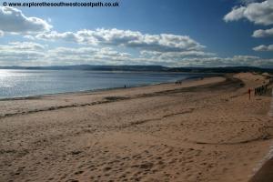
Once at Orcombe point there are two possible ways to go. At low tide you can walk right around the headland, and then continue along the beach to Sandy Bay. If it is high tide you will need to head up the zig-zag path at the end of the promenade and on to the coast path. There are steps down onto the beach a short distance along the path, and from there you can see if it's possible to get to Sandy Bay along the beach. If it's not possible or you don't want to, the path continues through some fields to Sandy Bay.
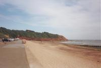
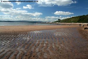
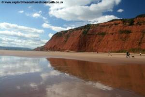
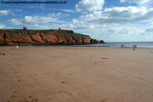
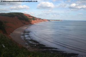
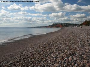
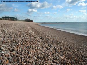
Sandy Bay is easily recognisable by the massive Devon Cliffs Holiday Park. It is closed during the winter, so you will find this part of the path quiet then. In the summer though it's very busy but the caravan park does have refreshments. The beach at Sandy Bay is excellent and is more secluded than the beaches in the town and is backed by high cliffs. The beach is far enough from the river Exe to avoid the currents which can cause problems in Exmouth so the beach offers safe bathing and clean water. Take care at the back of the beach though as there are cliff falls.
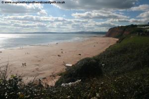
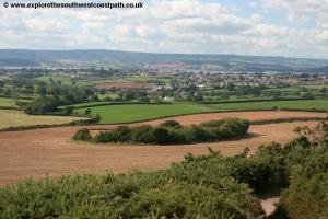
The next headland is used by the marines as a firing range, so unfortunately it is not possible to walk along it. The path goes along the edge of the caravan park and climbs quite steeply in places but is generally well signed. There are excellent views from this part of the path, into Budleigh Salterton and Sidmouth ahead and to Exmouth and right round to Start Point in the South Hams on a clear day. Once you reach the top of the cliff the path descends slowly through gorse bushes and pine trees into Budleigh Salterton. There are plenty of seats along this section and the walk is fairly easy although the path is quite thin in places.
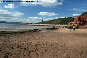
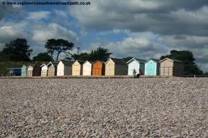
The path turns to tarmac as you come into Budleigh Salterton, with lots of seats down to the beach. The beach is quite good, although it is shingle and there are boats on the eastern edge of the beach. At the end of the beach the river otter flows into the sea. There are refreshments available in the town.
Bus services run approximatly every 30 minutes from Budleigh Salteron to Exmouth. The journey takes 20 minutes. For more information call 01392 427711 or click the links below.
Here are some photos of the walk. Click a picture for a larger version and description.
 |
 |
 |
 |
 |
 |
 |
 |
 |
 |
 |
 |
 |
 |
 |
 |
 |
Ordnance Survey Landranger map 192 covers this area of the coast path and is available from most book shops nationwide. It is also stocked at the tourist information centres in Exmouth and Budleigh Salterton.
![]() Multimap is a web site which provides maps of the UK, including around around Exmouth and Budleigh Salterton. The links below will be of most use to the coast path from Exmouth to Budleigh Salterton. These maps join to provide the complete coast path between the two points.
Multimap is a web site which provides maps of the UK, including around around Exmouth and Budleigh Salterton. The links below will be of most use to the coast path from Exmouth to Budleigh Salterton. These maps join to provide the complete coast path between the two points.