|
|
|
|

|
|
| Distance : 8 miles | Grading : +++ | OS Sheet : 202 |
![]()
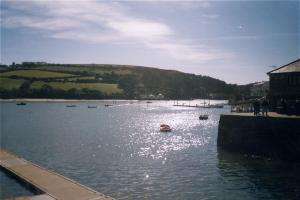
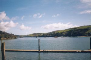
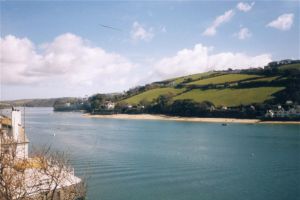
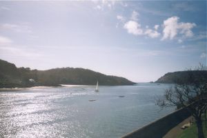
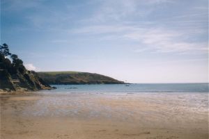
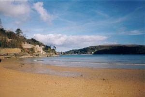
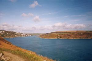
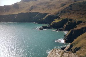
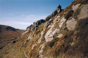
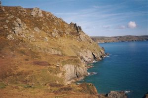
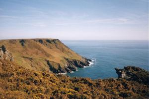
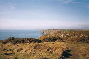
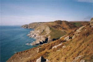
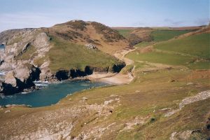
This is a circular walk from Salcombe, along the coast to Soar Mill Cove and back again. This is because of the very limited transport in the area. It is possible to take a short cut in either of the directions, by using the ferry between South Sands beach and the town centre. This is a very scenic walk, starting in the town of Salcombe at the end of the Kingsbridge Estuary. This area is very popular for water sports. The path goes along the edge of the river estuary, where there is some walking on the edge of the road. Here there are excellent views across the estuary to East Portlemouth, which has some wonderful beaches. There are small but pleasant beaches at North Sands and South Sands before the path leaves the road. From here the views are spectacular, particularly around Bolt Head. It is possible to see Burgh Island at Bigbury ahead on a clear day. After walking along the cliffs the small sandy beach at Soar Mill Cove appears, where you can take a break before returning. It is possible to continue along the path to Hope, rather than turn round, but you will most likely need to organise a taxi back.
![]()
Salcombe is best accessed along the A381 from Kingsbridge, where it joins the A379 to Dartmouth.
By public transport there are frequent buses from Kingsbridge. From Kingsbridge there are buses to Totnes (for rail services) and also some services to Exeter and Plymouth. For more information see the links below.
There is a fair choice of accomodation in Salcombe. There is a tourist information centre in Salcombe, which can help with accommodation. The accommodation at Soar Mill Cove is more limited, with just Soar Mill Cove Hotel and Soar Holiday Camp.
The following links are useful for finding accommodation in and around Salcombe.
This is a circular walk from Salcombe to Soar Mill Cove and back again. However Soar Mill Cove is approximately 2/3 of the way to Hope, so it's quite possible to carry on to there, but it's not too easy to get back again. Salcombe is a pretty estuary town with excellent views and lots of water sports. There is also a famous dairy here which makes excellent ice cream. The first part of the walk takes you along the river side. Although this is mostly road walking the views across the river to East Protlemouth and the lovely beaches are excellent.
There are ferries from Salcombe to East Portlemouth, to South Sands and to Kingsbridge, although some are summer only. If you walk to South Sands, you will also path North Sands beach. Both these beaches are sandy and both have seaside awards. They are very small at high tide though, but are quiet and sheltered. From South Sands beach the coast path leaves the road and offers some spectacular scenery. The rocks around Bolt Head make this part of the coast look quite similar to parts of the North Devon coast.
From Bolt Head the path is fairly hilly, but not too steep and there are excellent views along the South Hams Coast towards Bigbury and Burgh Island. Soar Mill Cove is not obvious until you are virtually on top of it. From here there is a steep climb to the cliff top if you want to continue to Hope. Alterntavily, there is a path inland which will take you back to the road.
If you are walking back from here, follow the same route back, although in summer there is a ferry from South Sands back to the town centre to save the walk along the road.
If you walk to Soar Mill Cove and back again there will be no need to get back, however if you finish at Soar Mill Cove you will need transport back. There are no buses from Soar Mill Cove, so the only public transport is a taxi, but I would recommend taking the number of a local taxi company with you, or try the national line on 0800 654321.
Here are some photos of the walk. Click a picture for a larger version and description.
|
|
 |
 |
 |
 |
 |
 |
 |
 |
 |
 |
 |
 |
Ordnance Survey Landranger map 202 covers this area of the coast path and is available from most book shops nationwide. It is also stocked at the tourist information centre in Salcombe.
![]() Multimap is a web site which provides maps of the UK, including around around Salcombe. The links below will be of most use to the coast path from Salcombe to Soar Mill Cove. These maps join to provide the complete coast path between the two points.
Multimap is a web site which provides maps of the UK, including around around Salcombe. The links below will be of most use to the coast path from Salcombe to Soar Mill Cove. These maps join to provide the complete coast path between the two points.