|
|
 |
|
|
| < Noss Mayo to Mothecombe |
| Distance : 12 miles | Grading : +++ | OS Sheet : OL20 |
![]()
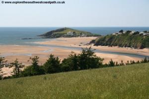
This walk takes in the coast between two river estuaries, the Erme and the Avon. The walk begins from Bigbury-on-Sea and initially follows the coast east to the river Avon the eastern of the two estuaries and then returns west by the same route, passing Burgh Island and then following the coast west past the beaches of Challborough and Westcombe Beach and rounding the rocky cliffs of The Beacon round to Wonwell beach and the river where we continue north taking a footpath east through woodland to the village of Kingston and then a pleasant bridlepath down to Westcombe Beach returning to Bigbury along the coast path.
![]()
Bigbury-on-Sea can be reached from the A38. Exit at the junction with the A3121 (for traffic heading west only) and follow this through Ermington to the A379. Turn left onto the A379 through Modbury and then lookout for the right turning to Bigbury along the B3392. This road goes through St Ann's Chapel and Bigbury and finishes up at Bigbury-on-Sea. There are three possible options for parking, The first is the self-styled “economy car park”, essentially a farmers field which is on the right just as you descend towards the village, this currently costs £1 per day and is on the coast path. Further down the road right by the coast path is a small car park on the left of the road with room for around 20 cars and is free of charge (but likely to fill early). Finally the main car park is at the bottom of the road with a large amount of pay-and-display parking in both an upper and lower car park as well as an overflow car park in the peak summer. This car park also has a cafe, toilets and a shop but is the most expensive for an all-day stay.
Sadly Bigbury-on-Sea is essentially inaccessible if you do not have access to a car as there is only one bus a week to Bigbury-on-Sea which runs on Fridays only from Plymouth arriving in the mid-afternoon. Sadly the fairly regular bus that used to run from Ivybridge station to Bigbury-on-Sea stopped running several years ago. Therefore to access this walk by public transport you will need to call a taxi. The nearest station is Ivybridge. This is also the reason why this walk is a circular walk as with no public transport you will need to be able to get back to your car. This is also a difficult walk for through walkers as there is no ferry across the river Erme to the west of Bigbury (you will have to wade across which is only safe at low tides when conditions are calm and the river low enough). To the east, a ferry does run over the Avon during the summer only normally between 10 and 11am and 3 to 4pm only.
![]()
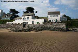
The main hotel on the walk is the Burgh Island Hotel, a luxury hotel situated on Burgh Island just off the coast path. The island can be reached at low tide by walking across the beach or there is a sea tractor at high tide. The hotel is not cheap however, the cheapest room being £400 a night at the time of writing, and you also have to book for two nights if you stay on a Saturday night. A cheaper option is The Henley Hotel which is in Bigbury on Sea. The Royal Oak is a pub in Bigbury (around 1.5 miles north of Bigbury-on-Sea) which has 4 rooms for accommodation. The Summer Winds bed and breakfast is welcoming to walkers and has 3 rooms and be contacted by telephone on 01548 810669. Parkdean Holidays have a large caravan site at Challaborough Bay on the coast path, although you will typically have to book for at least 3 nights here. Finally Mount Folly Farm is a campsite on the coast path on the edge of Bigbury-on-Sea.
![]()
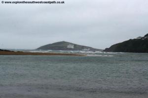
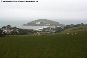
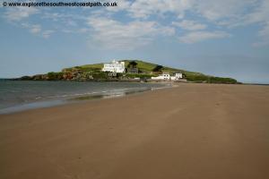
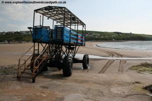
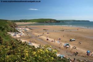
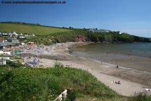
From the car park at Bigbury-on-Sea head east with the sea on your right to the right hand edge of the car park. Here you take the coast path on the right which is initially a short path along the low cliff top adjacent to the road which soon descends down via steps to the beach via the slipway. To your right can be seen Burgh Island. This is a tidal island so you can walk out to it at low tide and at high tide there is a sea tractor service. The island houses a luxury art-deco hotel, a pub and a few private houses and there are also some footpaths on the island.
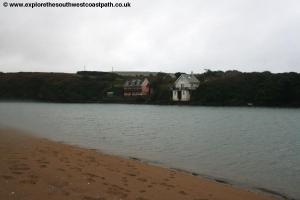
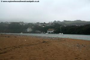
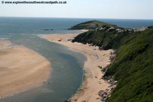
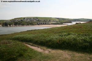
Continuing the walk take the road up the slipway to a small parking area and then just before this turn right on the signed coast path onto a grassy area. Here don't be tempted to take the most coastal route as this is a dead-end, instead keep to the signed coastal path. This heads straight for the first house you can see ahead and then on reaching it turns left, runs past the first house on the right and then turns a little to the left away from the houses and the sea to reach the road. Here turn right and then cross the road into the signed “Economy Car Parkâ€, a field. You then turn right on the permissive path through the field on the right hand edge of the field, parallel with the road. Continue on the right hand edge of the next field and again into the third field. At the end here you turn right on the track leading to the road through the gate. Cross the road and take the track straight on. As the track turns a little to the left you go straight on through a gate into a field. Follow the footpath along the right hand edge of this field heading down hill. Continue with the right hand edge of the field turning a little to the right and then back to the left, now right along the cliff top. The track soon goes through a wooded area passing an old boat house on the left and then comes down to the beach at Cockleridge Point. Now follow the path ahead until you reach the end of the point by where the ferry goes (in the summer only). This is the River Avon one of a number of estuaries in the area.
Once you have taken in this beach re-trace your steps back the way you came to reach the car park at Bigbury-on-Sea once more.
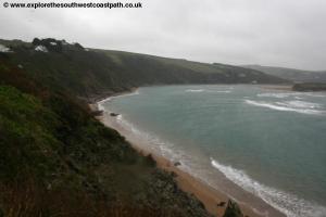
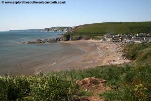
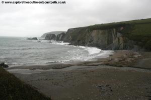
Once back at the main car park take the path just to the right of the beach shop, heading up hill along a road into the overflow car par. Continue here past a new block of flats on the left and through the car park. It soon rejoins the road where you turn right and follow Marine Drive,heading north. After the last of the houses the road soon narrows to a track and you continue due north along the wide track about Challaborough beach. Keep to this track as it soon descends down into Challaborough. Challaborough is almost entirely dedicated to tourism with a large caravan and chalet park dominating the village. Follow the road along the back of the beach and then as the road turns to the right, away from the sea you turn left on the signed coastal path. On reaching the cliff top turn right and follow the path up steps to follow the cliff top. The path continues to climb along the cliff top to Tobys Point where you then descend steeply down to the small rural beach at Arymer Cove, a beautiful beach a mixture of sand shingle and rock with grey slate like rocks on either side. The remote location of this beach means it's quite likely you will be the only one there.
The coast path then climbs steeply away from the beach right along the cliff top and then very soon descends down to Westcombe Beach. This is another remote and beautiful beach which is again a mixture of rock, shingle and sand. You take the steep path which twists and turns down to the beach and then cross a stream flowing along the valley via a footbridge. The coast path then climbs up the cliffs on the other side of the beach (where there are odd zig-zags visible in the grass). Soon the path levels up as you round Hoist Beach although there is no access to this beach. Follow the obvious coast path around the cliff top on the other side of the beach and continue over another bridge over a little stream. Soon you overlook another rocky beach this time by Meddrick Rocks. Continue round on the cliff top to Gutterslide Beach, another small and inaccessible beach. The path now goes out to Beacon Head offering good views back to Burgh Island. From here the path turns north with the cliffs so you lose the views of Burgh Island. You round the beach at Fernycombe Beach another beach which is inaccessible and then just round the corner there is a permissive path out to Scobbiscombe Farm and on to Kingston.
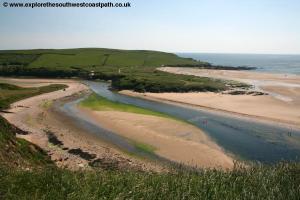
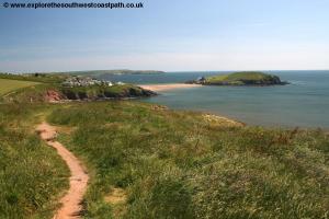
Soon you reach Muxham Point as the path descends and ahead of you there is the beautiful River Erme. The path then goes through woodland and round to the attractive sandy beach of Wonwell. The path descends onto the back of this beach and then back up the other side soon entering woodland and finally becoming a road. The coast path ends here with the official route being to wade across the river Erme to the west, but this is only possible at low tide (and even then only if the river is not to deep).
Instead to make it a circular walk, continue up the road and after around 150 metres look out for a signed footpath up to the right. This goes into the woodland and climbs fairly steeply all the way through the woodland. This emerge into a field and you go straight ahead over the stile and follow the right hand edge of the field. Go over another stile into the second field and continue on the right hand edge of the field to a second stile. Cross this and ahead take the path between hedges with fields beyond the hedges. This emerges into a field which you cross heading exactly due east then on reaching the field edge on your right keep this to your right until the path comes out onto a minor road. Here turn right and follow this minor road for around 500 metres to reach the village of Kingston.
At a junction continue on the road straight ahead until it reaches a T-junction. Here turn left and then take the next road on the right, signed as a dead-end (but only for vehicles). At the end of the road it continues as a track signed as a bridleway. Take this (ignoring the footpath signed to the left) and keep to this wide bridlepath with a stream and some ponds along the left. You now follow this bridlepath along the valley for around 2 miles always keeping to the main path straight ahead. The path can be wet and muddy in places. At some point near the end the path ahead becomes a permissive path which you follow beside the stream to come down to the beach at Westcombe Beach. Here you turn left and continue along the coast path, back to Bigbury-on-Sea.
![]()
Unlike the other walks on this website this walk is a circular walk, so there is no need for public transport back to the start of the walk. The walk is however a circular walk due to the lack of any public transport in the area and the difficulties of crossing the river estuaries.
![]()
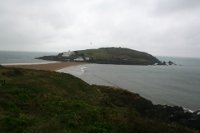
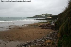
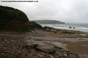
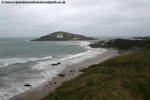
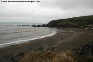
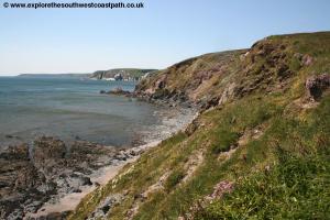
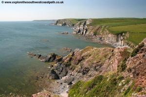
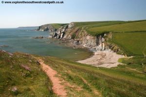
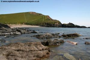
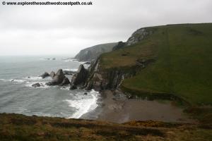
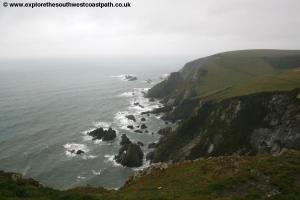
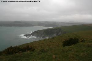
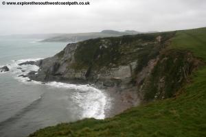
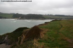
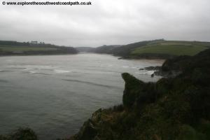
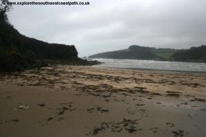
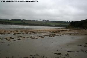
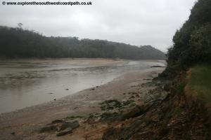
Here are some photographs of this walk. Sadly they were taken on a rather grey and wet day so do not show the area at it's best.
 |
 |
 |
 |
 |
 |
 |
 |
 |
 |
 |
 |
 |
 |
 |
 |
 |
 |
 |
 |
 |
 |
 |
 |
 |
 |
 |
 |
 |
 |
 |
 |
 |
 |
![]()
Ordnance Survey map OL20 (South Devon) covers this part of the coast and is widely available both nationally and locally as well as via online retailers.
![]()