|
|
 |
|
|
| < Paignton to Brixham | Torquay to Babbacombe > |
| Distance : 2 miles | Grading : + | OS Sheet : 110 |
![]()
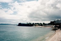
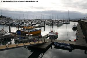
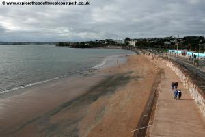
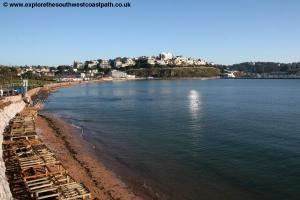
This is a walk linking Torbay's biggest resorts, Torquay and Paignton. Starting from Torquay harbour the path passes the mariners of Torquay and the sandy beach at Torre Abbey Sands before climbing onto Corbyn Head at the end of the beach. From here the path follows the road for a little while before it turns away at Hollicombe and goes back down to the beach. From Hollicombe head the path continues at the back of the beach into Paignton.
![]()
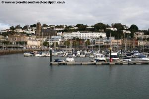
To reach Torquay, take the A380 off the A38, the main Exeter to Plymouth trunk road. This continues as a dual carriageway for a while, but at the edge of Newton Abott, it narrows to a single carriageway through Kingskerswell, which often causes traffic queues (but a new bypass opens in 2015, which should alleviate this). At the roundabout junction continue ahead on the A3022 through Torre to the sea front and then turn left to the harbour. It is recommended to park at the large multi-storey car park at the harbour.
Torquay is well served by public transport. The railway station is a couple of minutes walk from the coast to the west of the town. It has between 1 and 2 trains per hour from Paignton to the south and Newton Abbot to the north. Most trains continue east from Newton Abbot to Exeter and Exmouth (via Exeter). There are also some long distance trains to London and Birmingham. Trains to Torquay are operated by Great Western Railway and Cross Country Trains. In addition there is a good frequent local bus service from Paignton, Newton Abbot and Brixham. Longer distance buses also operate to Torquay from Exeter, Plymouth and Totnes. Buses around Torquay are operated by Stagecoach South West and First Devon and Cornwall.
![]()
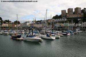
Your spoilt for choice for accommodation in Torquay and Paignton. There is a large range of hotels available in the area to suit all tastes and budgets. There is also a good range of self catering accommodation in the area, especially towards Paignton. There is a tourist information centre in Torquay, on the harbour side that carries full lists of local accommodation. For more information, see the links below.
![]()
From the road at the back of the harbour (Strand), turn left along the road just before the footbridge, turn right on the path around the corner, now with the marina on your left. Pass this and continue to reach the Princess Theatre on the sea front. Here the path joins the road and you round the corner past a new development of shops and flats and now have Torre Abbey sands to your left. There is a footbridge over the main road here into the town. The coast path now follows the road, with Torre Abbey park to the right. There is a lower promenade along the beach here however, which you might prefer. Soon you reach the Grand Hotel and the road on the right leads to the station, if you have arrived by train.
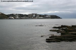
The coast path south from Torquay heads along the road to Corbyn Head. The coast path sticks to the road here, but you can walk out onto the head too if you want. Continue along the main road to Livermead Head. Here you pass the Livermead Cliff hotel. Just after this hotel, there is a path to the left. This isn’t the coast path and is a dead-end path, but it leads down to Institute Beach, a small sandy and rocky beach.
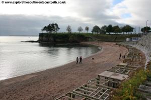
The main walk continues on the road, cutting off Livermead Head, as there is no path here. The road soon rises to cross the railway line and then comes to a nice garden on the left at Hollicombe. The coast path leaves the road here, and heads through this park. There are two possible routes here. The main route of the coast path is to turn right on the main path through the park, running parallel to the railway on the left and then pass over the railway at the far corner of the cliff. An alternative, if the tide is out, is to go straight ahead and take the small tunnel under the railway line, leading to Hollicombe Beach. Turn right along the beach, past the rock armour, and take the next path back up, which rejoins the coast path after the bridge over the railway line.
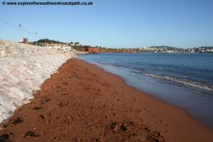
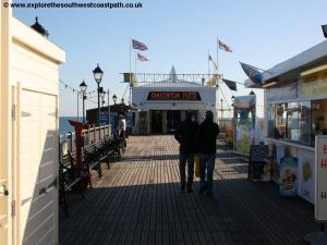
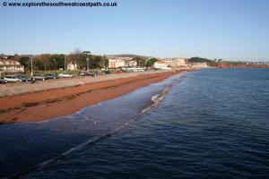
In either case, you now head along the tarmac path passing over Hollicombe head and then turn left to the promenade at Preston Sands. This is a sandy beach, although there is not much beach at high tide. Continue on the promenade until you are blocked by the large Redcliff Hotel ahead. Take the road around the front of the hotel and then go back down to the promenade, now on the main Paignton Sands. Follow the promenade along the back of the beach, soon to reach Paignton Pier.The pier has the usual mix of arcade and rides at the end. Continue along the promenade to the cinema. If you want to end the walk here, you can return to Torquay by train. Head inland along Torbay Road, a road lined with mostly tourist shops to reach the station. From here trains run between once and twice an hour back to Torquay. There are also steam trains south to Kingswear, beside the river Dart.
![]()
The easiest way to get back to Torquay is by bus. Stagecoach South West service 12 runs every 10 minutes Monday – Saturday and every 15 minutes on Sundays on a route between Newton Abbot and Brixham, via Torquay and Paignton. It departs from Paignton bus station which is adjacent to the railway station and a short distance inland along Torbay Road from the Vue cinema on the sea front. You can also return by train, with between 1 and 2 trains an hour between Paignton and Torquay, but note that the station in Torquay is around half a mile walk from the harbour, so you will be re-tracing some of your walk if you are returning to the harbour. Trains between Paignton and Torquay are operated by Great Western Railway and Cross Country Trains.
![]()
Here are some photos taken on this walk. Click each photo for a larger version and description.
 |
 |
 |
 |
 |
 |
 |
 |
 |
 |
 |
 |
 |
 |
 |
|
![]()
Ordnance Survey Explorer 110 (Torquay & Dawlish) covers the coast between Torquay and Paignton and is available in the tourist information centre in Torquay, from bookshops locally and from online retailers. The following links also show the maps of this area.
![]()