|
|
 |
|
|
| < Brean to Pawlett | Stogursey to Combwich > |
| Distance : 14 miles | Grading : ++ | OS Sheet : 140 |
![]()
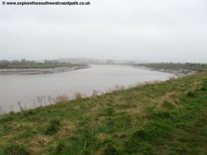
This walk follows the Somerset Coast as much as possible as the River Parrett needs to be crossed and the lowest crossing point is on the northern edge of Bridgwater, requiring a long diversion along the river bank, which makes up this walk. The walk begins from Combwich on the western side of the river and heads along the south bank of the river to the north edge of Bridgewater and crosses the A39 bridge, then continues on the eastern side of the river to Dunball and on to Pawlett.
![]()
From the M5 motorway exit at junction 23 and follow the signs for A38 Bridgwater. As you near Bridgwater turn right on the A39 (signed Minehead) to cross the northern bridge over the river. The A39 here now forms a northern bypass of the town and you continue on the A39 to the roundabout at Cannington. Here leave the A39 and go straight on into Cannington. After passing the church follow the road round to the left and then turn right signed for Combwich. On reaching Combwich turn right off the main road into the village centre. There is a small car park in the village on the north side of the stream but this is not especially convenient for this walk so it is better to park on street near the village shop if possible, parking with consideration for the residents.
It is worth noting that there is very limited public transport back to Combwich. It is only possible to use public transport to return to Combwich on Monday to Friday during college term times only, as there is just one bus a day.
Due to cuts in public transport and the previous bus operator (Webberbus) going bust, this walk is now impossible to do entirely by public transport unless you use a taxi as there are now only 2 buses a day on weekdays during Bridgwater collage term time only to Combwich. This is The Buses of Somerset route 14. This normally runs only between Cannington and Bridgwater however there is a single journey each way on weekdays during college term time that extends to/from Shurton via Stogursey and Combwich.
![]()
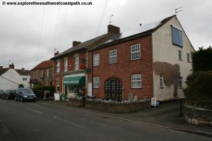
There is no accommodation in either Pawlett or Combwich, but the walk passes through Bridgwater which has a mixture of independent and chain hotels. There is both a Permier Inn and Travelodge in or close to the town, and a good range of independent hotels.
![]()
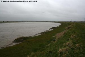
From the A39 in Combwich, head along the main street, soon passing the village store and post office on the left. Just after this the road splits, take the right hand fork with the stream on your right which you soon then cross on the bridge. At a track on the right turn right with the signed footpath and shortly afterwards you turn left on a path between fences. This crosses a road and then you continue straight ahead on the path between the fences with an electricity substation to the left. Soon you join the banks of the River Parrett and turn right, with the river on your left.
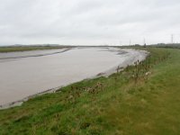
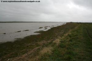
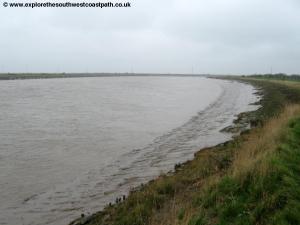
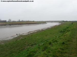
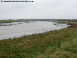
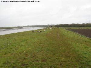
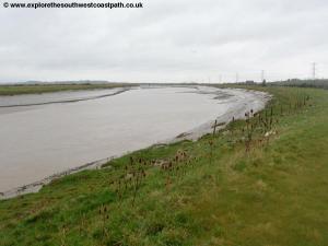
The next few miles are easy walking on the bank of the river. You cross a sluice gate at Tucketts Clyce and follow the river as it turns left to head due east briefly. Cross another sluice gate at Stallingtons Clyce and keep to the river bank heading north. Follow the path beside the river heading north and then curving east with the river.
After around 3 miles you have the village of Pawlett, the end of the walk, visible on the opposite bank of the river, with it's distinctive white church tower.
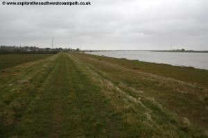
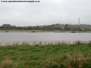
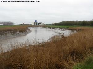
Follow the river bank path south from here beside the river and continue as you turn left with the river to head east and start to have heavy industry ahead as you approach Dunball on the opposite bank of the river.
Turn right to head south passing a large Morrisons distribution centre on the opposite bank of the river. You can also see numerous new developments being built alongside the A38 on the other side of the river. The path twists and turns with the river passing a sewage works on the edge of Bridgwater and then reaching the A39 bridge ahead.
We cross the river here and you join the bridge by taking the tarmac path to the right to a road and turn left along it, as it loops up to the road. Here turn left and cross the bridge on the road.
Once over the river there is a choice. There is a footpath immediately below on the eastern bank of the river, but the official access to it is a long way round, but you can get to it by climbing over the crash barrier and taking the well worn path. If you go this way turn left and follow the footpath until it joins the A38.
Alternatively, continue ahead on the A39 road to the junction with traffic lights. Then turn left along Wylds Road. At the A38 junction turn left along the A38. The alternative footpath route joins on the after about 400 metres.
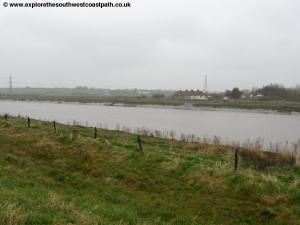
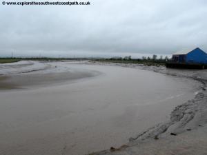
Both routes are now on the A38, a busy road which soon widens to dual carriageway. Thankfully there is a pavement, but we must follow this for around 1.5 miles to Dunball Wharf. Continue on the A38 until you cross the artificial cut on the bridge on the A38 to enter Dunball. Shortly after the bridge look out for the rather incongruous footpath on the left, into an industrial area. This path has recently been diverted and after passing the security hut on the left keep left of the main buildings, to reach the river and then turn right with the river on your left and the buildings on your right. At the end take the footpath straight ahead and through a gate back to the grassy river banks. Follow these with the river heading west and then turning to head north with the river.
You now continue until you reach a row of cottages after around 1 mile. Here you take the stile behind them, which appears to be the back gardens of the house (but is the correct route of the path), then just beyond, take the track up to the right. This soon becomes the public road and you continue along it, passing but ignoring Vicarage Lane on the right. At the junction with Gaunts Road turn right and follow this road as it turns to the left and you follow this to pass the post office on the right. On reaching the main road the walk ends here in the village of Pawlett.
![]()
To return to Combwich from Pawlett you have to use two buses and the latter of these runs only once per day, on weekdays during college term times only. At the time of writing (January 2017) you can take the following buses, but do check they are still running at the same times before setting out and ensure it is during the term time of Bridgwater college. First take The Buses of Somerset route 21 from Pawlett to Bridgwater Bus Station which depart Pawlett at 16:34 and arrives at Bridwater Bus Station at 16:47. Then depart Bridgwater Bus station on The Buses of Somerset route 14 which departs at 17:05 and arrives at Combwich at 17:38. If you miss this bus (or the connection in Bridgwater) you will need to call for a taxi.
![]()
Here are some photos taken on this walk. Click each photo for a larger version and description.
 |
 |
 |
 |
 |
 |
 |
 |
 |
 |
 |
 |
 |
 |
 |
|
![]()
Ordnance Survey Explorer map 140 (Quantock Hills & Bridgwater) covers this walk. It is available from local book shops, tourist information centres and online retailers. In addition the links below show the map of this area.
![]()