 |
|
|
| Distance : 11 miles | Grading : +++++ | OS Sheet : 126 |
This walk begins in Westward Ho! with it's rocky and sandy beach and as you head west the walk initially follows the route of an old railway line but soon becomes very hilly with a large number of ascents and descents but stunning views. You soon pass through the lovely village of Bucks Mills and follows the Hobby Drive west to end in the unique village of Clovelly, with its very steep and winding cobbled streets and many pretty cottages.
Westward Ho! is just off the A39 Atlantic Coast Highway. If you are coming from the east (the direction of Barnstaple) just after crossing the high Bideford bridge, turn right onto the A386 for Northam and Appledore and fork left onto the B3236 for Westward Ho! There is a large pay and display car park near the sea front. From the A39 coming west from the direction of Bude, follow the A39 for Bideford turning left onto the A386 at the Bideford junction and then follow the directions as above.
If you're using public transport, there are frequent bus services to Westward Ho! from Barnstaple and Bideford, seven days a week. See the link below for full details of public transport around the South West Coast Path in North Devon, including links to timetables.
There are a lot of camp and caravan sites around Westward Ho! as well as some Hotels. At Clovelly there are two hotels and a camp site close to Clovelly cross. There is a tourist information centre in Bideford, which carries a full list of accommodation in the area. For more information see the links below.
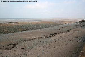
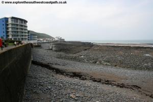
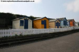
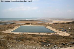
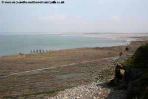
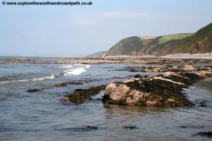
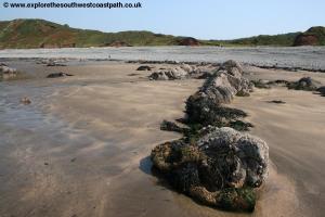
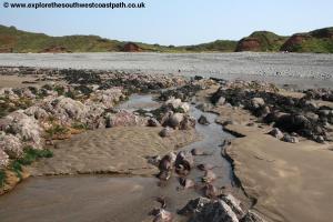
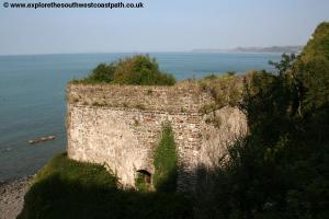
Westward Ho! is an interesting town. The golden sands of the towns beach are popular with surfers, being west facing and the pebble ridge behind protects the low-lying Northam Burrows from flooding. From the sea front turn left, keeping the sea to your right. You pass some modern flats on the sea front and beyond, numerous beach huts with several caravan and chalet parks behind. The beach has now given way to rocks, a feature of this part of the coast line as already the coast can be seen to be changing from the sand and dunes around the Torridge estuary. You pass the tidal swimming pool cut into the rocks and continue past a single old and rather run-down house on the right and then come to a pleasant grassy area with numerous seats. Continue west along here and at the end you join a tarmac path heading west. This follows the former track bed of the former Bideford to Westward Ho! railway and hence the path is initially very flat. You continue as the path gradually rises to leave rocky cliffs to the right. As you approach Cornborough Range the old railway turns left and you take the footpath straight on. Here the roller-coaster begins, as the path now makes several climbs before returning to sea level where you must once more regain height. First you go over Cornborough Cliff then on to Abbotsham Cliff, Green Cliff and Cockington Cliff. Most of these cliffs have little streams at their base and in some cases there is beach access.
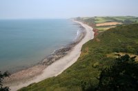
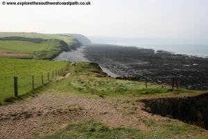
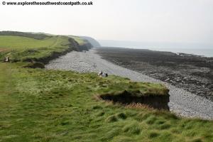
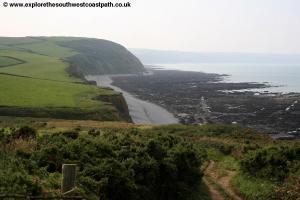
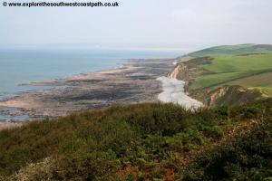
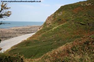
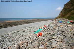
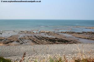
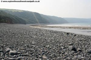
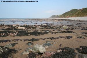
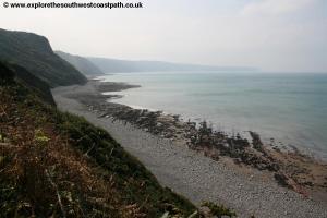
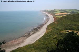
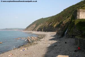
At Cockington cliff the coast turns slightly west, and the path is briefly a little back from the coast. Soon after this point follow the well-signed path as it heads around the edge of several fields. At Babbacombe Mouth there is access to the rocky and pebbly beach. The coast path continue south up a steep climb to Higher Rowden from where you have stunning views over the bay and back along the coast towards Westward Ho!. You then return to field-edge paths from Higher Rowden until you have access onto Peppercombe beach. This is a lovely beach and usually deserted, due to it's remote location. There are pebbles at high tide and sand and rocks at low tide, it's a lovely place to rest a while.
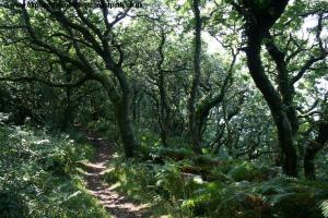
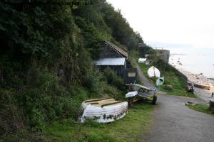
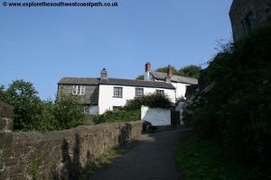
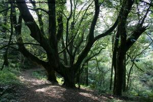
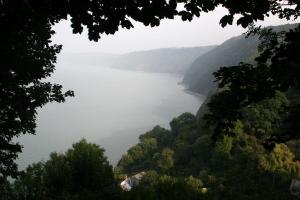
From Peppercombe the path again rises and follows the edge of the field close to the cliff top and then follows the cliff top edge path for a short while then heads inland a little distance around a valley. Cross the track to the house to the right and be sure to stop and enjoy the view to the right, offering beautiful views back down to Peppercombe and back all along the bay. The path ahead is now mostly wooded for the next few miles, following through the southern edge of Worthygate Woods. This is a beautiful area of woodland and on a hot day provides welcome shelter. Follow the path through the woodland and briefly field edge (it is very well signed), all the way to you descend down into the road at Bucks Mills. Bucks Mills is a lovely place, with the white-washed houses clinging to the edge of the steep road and down to the cliffs, where there is a path to the beach. The beach is largely shingle and rocks but is a very beautiful place with it's fishing huts, boats and waterfall tumbling onto the beach, it is well worth the short diversion from the path. The area was well known for it's lime, with several lime kilns in varying states of repair above the beach. In my opinion, Bucks Mills is almost as attractive as nearby Clovelly with the bonus it tends not to attract the huge number of tourists the flock to Clovelly.
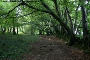
From the beach at Bucks Mills retrace your steps up the road and turn right when signed along the coast path, up some steps and into woodland once more. The woodland walk is very well signed and just avoids the large Bideford Bay holiday camp. Continue along the well signed path as it passes through the southern edge of the woodland that covers the cliffs in this area. You briefly follow the edge of a field before re-entering the woods to the right. There is some beautiful ancient woodland on this section of the path. You now join the wide track, known as the Hobby Drive. This wide track winds it's way through the woodland above Bucks Mills and almost doubles back on itself in places! This part of the path is largely wooded, but there are occasional glimpses of the sea and down to Clovelly bay from the path and seats beside it. The track zig zags down and soon meets the minor road into Clovelly. Follow the path to the right down into the village.
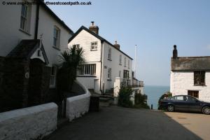
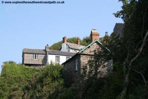
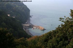
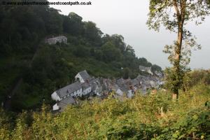
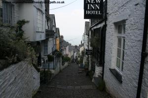
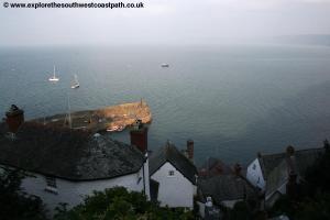
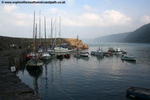
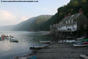
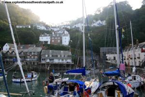
Clovelly is a beautiful village and one that is very well known. The village is built around a single very steep and stepped cobble drive. As a result of the stones, cobbles, steps and steep slope the main village street is pedestrianized. This makes the village largely unique, since the residents of the houses and business often use sledges to transport goods up to the road. The village is very attractive, with it's white-washed cottages tumbling down the very very steep track to the sea. At the bottom of the steep road is a harbour, with a fleet of fishing boats and the beach at the bottom is again pebbly with a beautiful waterfall. Boats leave from the harbour for local sightseeing trips and trips to Lundy Island during the summer months. If, after the long walk, you can't face the walk back up the street there is during the summer a land-rover service back up a parallel service road to the visitor centre at the top of the hill. If you prefer to walk, make your way up the steep cobbled street to the top of the village and continue following the signs for the visitor centre. Here it may come as a surprise - visitors arriving by road are expected to pay an admission charge to the village, something that you avoid by arriving on the coast path on foot! If the visitor centre is open enter it to reach the road beyond. Otherwise there is a path to the left of the visitor centre and out into the car park, the end of the walk.
From the visitor centre car park there are several buses a day Monday - Saturday (and a limited Summer Sunday service) to Hartland in the west and to the east to Bideford and Barnstaple via Abbotsham. From Bideford there are frequent buses back to Westward Ho! at the start of the walk. For details of this and other bus services in North Devon please see the link below. Due to the infrequent service you may prefer to do the walk in reverse, taking the bus to Clovelly and then walking back to Westward Ho!
Here are some photos of the walk. Click each picture for a larger version and description.
 |
 |
 |
 |
 |
 |
 |
 |
 |
 |
 |
 |
 |
 |
 |
 |
 |
 |
 |
 |
 |
 |
 |
 |
 |
 |
 |
 |
 |
 |
 |
 |
 |
 |
 |
 |
Ordnance Survey Explorer map 126 covers this area of the coast path and is available from most book shops nationwide and many local shops, including at Clovelly.
Streetmap is a web site which provides maps of the UK, including around Westward Ho! and Clovelly. The links below will be of most use to the coast path from Westward Ho! to Clovelly. These maps join to provide the complete coast path between the two points.